Social Studies 5th Grade
Geography Unit: Midwest America
VA SOL NAG 5.5c The student will explore the Midwest region of the United States by analyzing the natural resources and economic activity of the Midwest region.
Essential Question for the Year: How does geography impact the growth of a nation?
Essential Question for the Unit: What are the major Midwest contributions and lessons to our economy, history and technology
Lesson 3: What are the natural resources and economic strengths and weaknesses of the Midwest?
Objective: Students will be able to analyze the relationship between geography, natural resources and economic growth of the region using thematic maps as resources.
Materials: Chart paper, markers, Promethean Board, Harcourt Social Studies textbooks, laptops
Preassessment (3 minutes)
On a sheet of paper, students will define “natural resources” and “economic activity" in their own words. Then, they will list as many as they can think of for each definition that might be in the Midwest.
Procedures
Link (10 minutes)
Teacher and students will look at different thematic maps on the Promethean and discuss what they see and why it might be located in that region of the Midwest.
Land Use: Click Here
Population Density: Click Here
Key Questions: How does the geographic features of certain areas relate to the natural resources found there?
What might cause such extreme differences in populations between capital cities and other areas of Midwestern states?
What are some logical conclusions we can come to based on the population density and land use maps?
What affect does the economy have on the lifestyles of the residents in this state? (Work, education, home life, retirement etc)
Instruction (Center Rotations: 30 minutes)
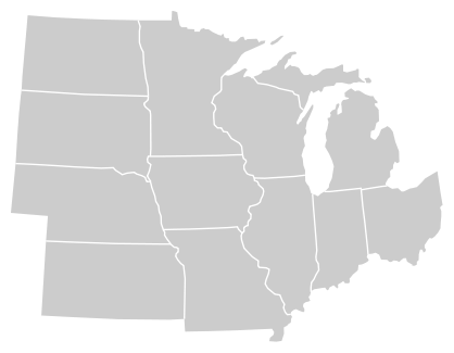
Students will be using the thematic maps found on the website above and the one in Harcourt (p250) to become experts about the states in the Midwest. Students will have a large empty map (one per center rotation) where they collaboratively can add natural resources and economic activities to the map. The map must include a key for each natural resource, economic activity or population information, as well as have each state labeled. Students may choose among the group how to decode these elements of the map, and may split the work however they see most time efficient.
Suggestions include: some students become expert researchers, other expert "cartographers" (explain term prior). Split the time between researching and mapping. Divide states among students to research and label. etc. Interactive vs Independent Learning choice
Key Questions to Answer: What are the most common natural resources found in this state?
What are the most common occupations found in this state?
According to the population density map, where are the most people located and why? What brings them to those particular areas?
How are the natural resources in this state used in the rest of the country?
Output (Products, Ideas, Problem-Solving & Research)
Completed map charts will be hung around the room until the completion of the Unit.
Students will join together after center rotations to compare their maps and the accuracy of information found through research.
Assessment
Students will complete an exit card answering the following: What role I played in my group (researcher, cartographer, expert on Ohio etc) and one thing I learned that surprised me from this activity.
The charts that students produce will serve as a concrete assessment for completion, legibility and correct labeling.
Differentiation
By Process: Students will be working together but may divide roles according to personal strengths and weaknesses.
By Content: Students will be researching and labeling a variety of natural resources, states, economic activity, population etc. They will be using both text and internet resources.
By Product: Students will use the exit card as an explanation of their strength and contribution to the group in addition to being assessed one the map.
Map creation will benefit visual and kinesthetic learners.
Research options will benefit naturalistic and linguistic learners.
Geography Unit: Midwest America
VA SOL NAG 5.5c The student will explore the Midwest region of the United States by analyzing the natural resources and economic activity of the Midwest region.
Essential Question for the Year: How does geography impact the growth of a nation?
Essential Question for the Unit: What are the major Midwest contributions and lessons to our economy, history and technology
Lesson 3: What are the natural resources and economic strengths and weaknesses of the Midwest?
Objective: Students will be able to analyze the relationship between geography, natural resources and economic growth of the region using thematic maps as resources.
Materials: Chart paper, markers, Promethean Board, Harcourt Social Studies textbooks, laptops
Preassessment (3 minutes)
On a sheet of paper, students will define “natural resources” and “economic activity" in their own words. Then, they will list as many as they can think of for each definition that might be in the Midwest.
Procedures
Link (10 minutes)
Teacher and students will look at different thematic maps on the Promethean and discuss what they see and why it might be located in that region of the Midwest.
Land Use: Click Here
Population Density: Click Here
Key Questions: How does the geographic features of certain areas relate to the natural resources found there?
What might cause such extreme differences in populations between capital cities and other areas of Midwestern states?
What are some logical conclusions we can come to based on the population density and land use maps?
What affect does the economy have on the lifestyles of the residents in this state? (Work, education, home life, retirement etc)
Instruction (Center Rotations: 30 minutes)
Students will be using the thematic maps found on the website above and the one in Harcourt (p250) to become experts about the states in the Midwest. Students will have a large empty map (one per center rotation) where they collaboratively can add natural resources and economic activities to the map. The map must include a key for each natural resource, economic activity or population information, as well as have each state labeled. Students may choose among the group how to decode these elements of the map, and may split the work however they see most time efficient.
Suggestions include: some students become expert researchers, other expert "cartographers" (explain term prior). Split the time between researching and mapping. Divide states among students to research and label. etc. Interactive vs Independent Learning choice
Key Questions to Answer: What are the most common natural resources found in this state?
What are the most common occupations found in this state?
According to the population density map, where are the most people located and why? What brings them to those particular areas?
How are the natural resources in this state used in the rest of the country?
Output (Products, Ideas, Problem-Solving & Research)
Completed map charts will be hung around the room until the completion of the Unit.
Students will join together after center rotations to compare their maps and the accuracy of information found through research.
Assessment
Students will complete an exit card answering the following: What role I played in my group (researcher, cartographer, expert on Ohio etc) and one thing I learned that surprised me from this activity.
The charts that students produce will serve as a concrete assessment for completion, legibility and correct labeling.
Differentiation
By Process: Students will be working together but may divide roles according to personal strengths and weaknesses.
By Content: Students will be researching and labeling a variety of natural resources, states, economic activity, population etc. They will be using both text and internet resources.
By Product: Students will use the exit card as an explanation of their strength and contribution to the group in addition to being assessed one the map.
Map creation will benefit visual and kinesthetic learners.
Research options will benefit naturalistic and linguistic learners.
Map option students will use to label.
